4. Connecting to Minnesota's Forests: Past, Present and Future

Resident Artist Research Project

banner3 copy.jpg

4. Free Art In the Woods & at the Bell

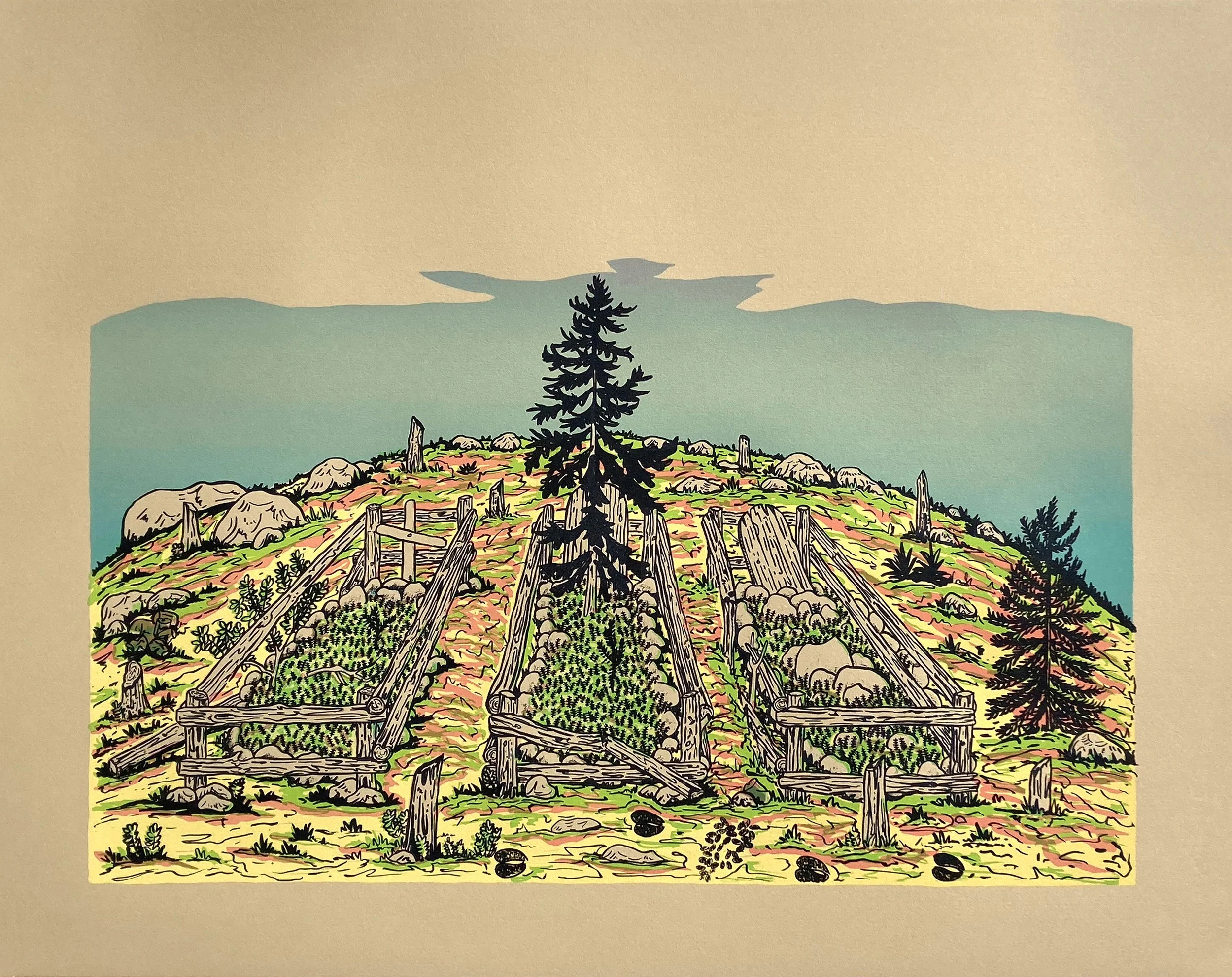
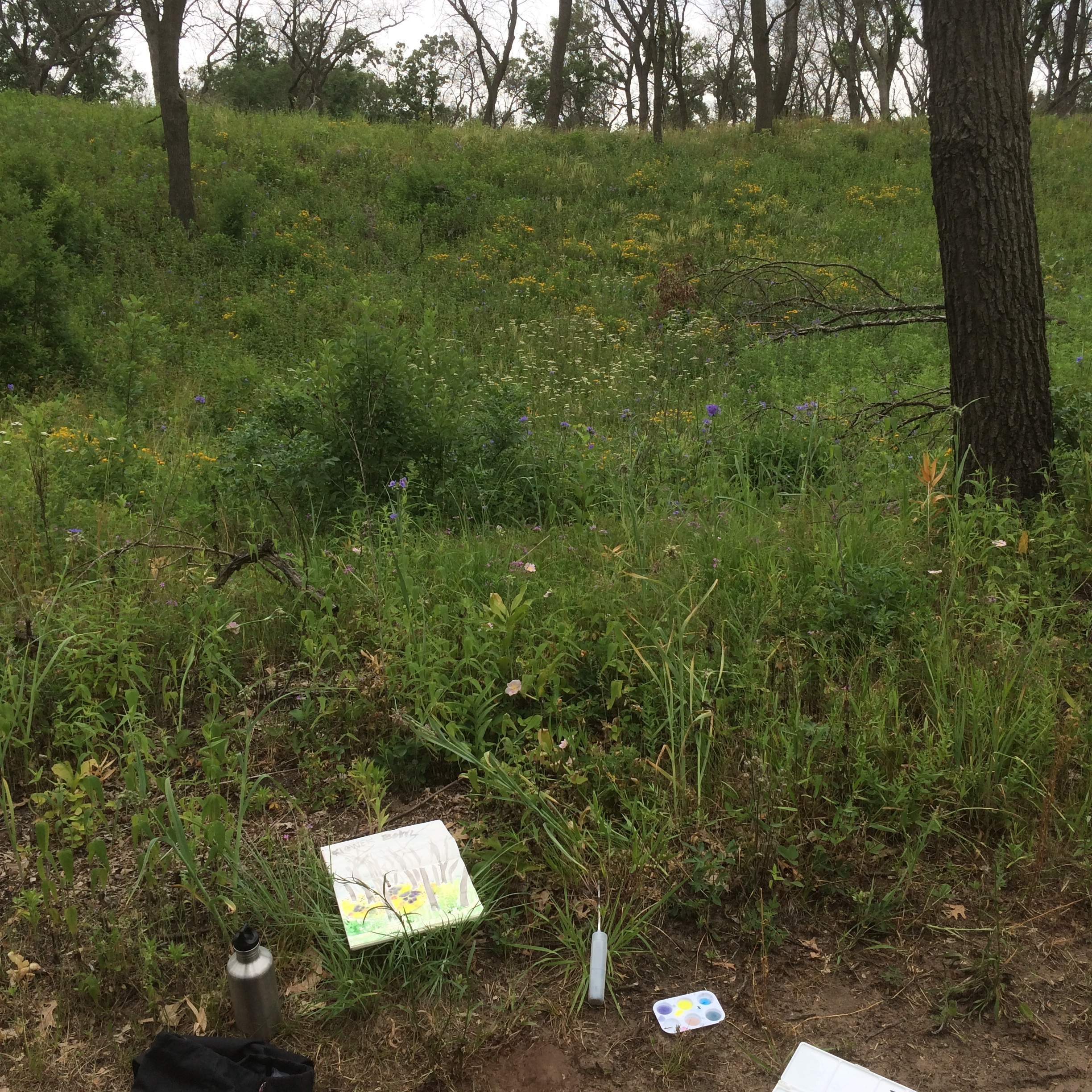
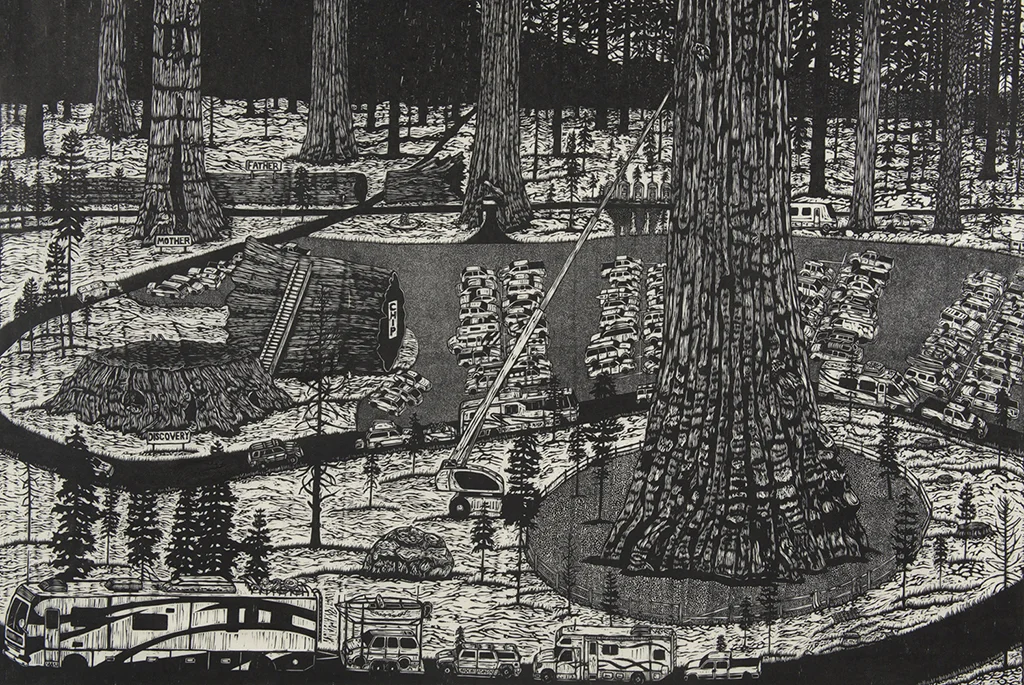
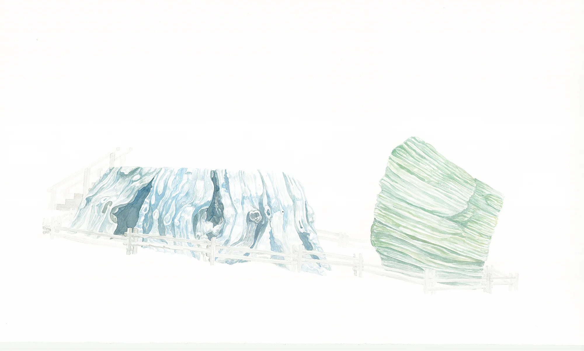
I created a geocache project for the Bell Residency to get work outside, accessible, and available to anyone up for a walk in the woods. The prints reference the theme of connection spread throughout the residency work. In this case, connection to the forest, its roots, and its fruits. The image was conceived in the pandemic springtime. One of those moments where everything was just right despite our human reality. The morning sun raking the forest floor, turkeys gurgling nearby, morels poking through the leaves, the forest miraculously starting up again.

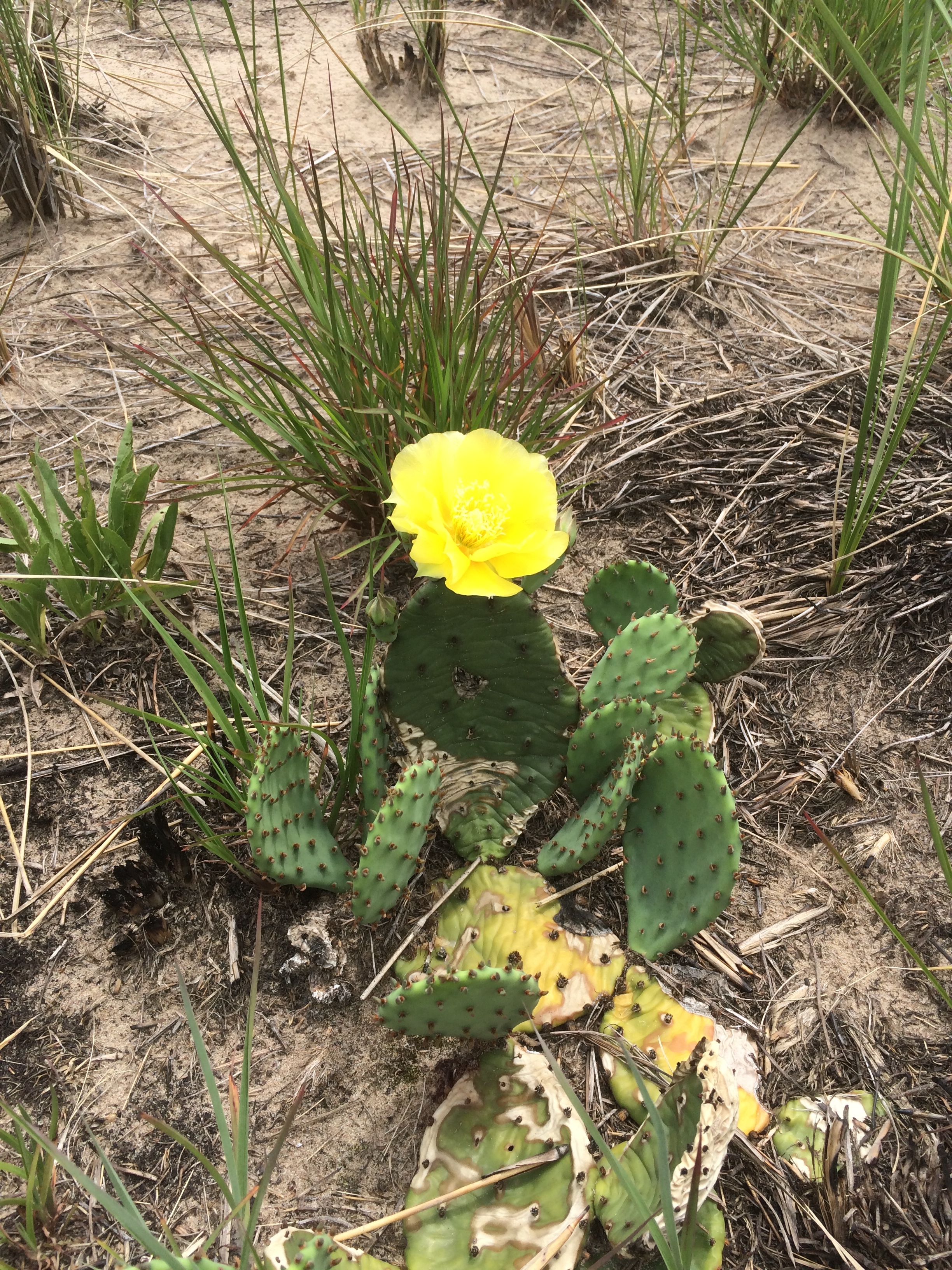
I was also thinking about the sharing economy of the forest, the fungal networks sharing nutrients below ground, collaborations between species, and the complexity of interaction around us that we can only begin to glimpse. Plants and fungi have been growing and knowing for hundreds of millions of years before us. We evolved in their world. A world that has nourished us. How can we protect it, reforest it, reflood it, release it from our grasp a little?

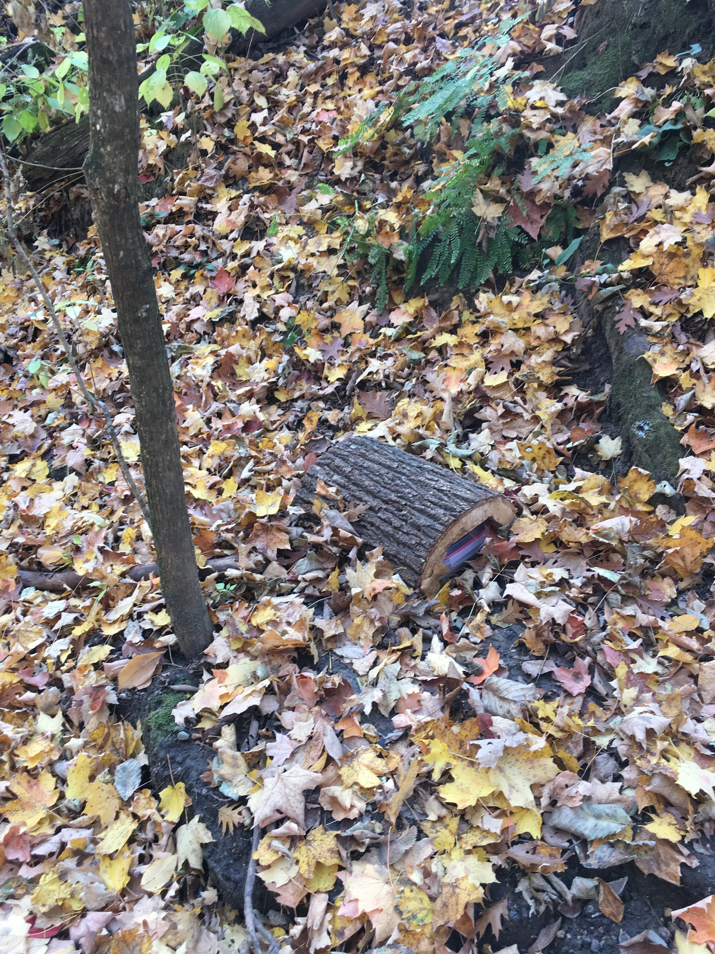
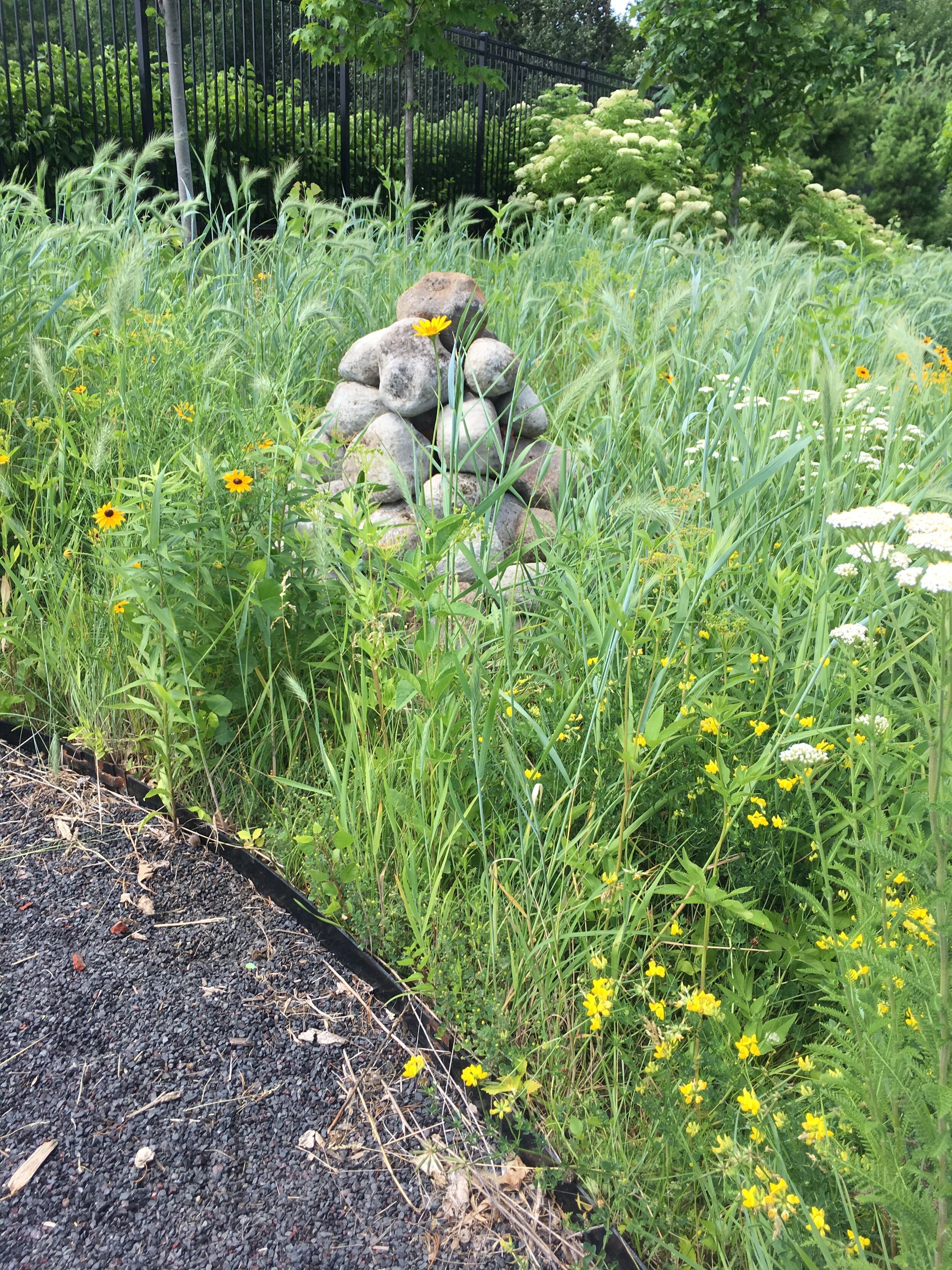
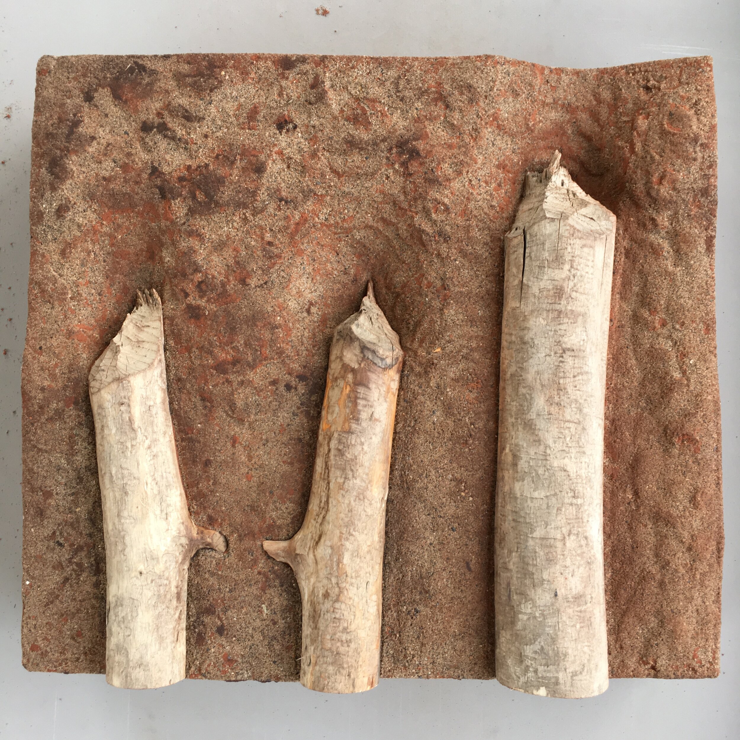
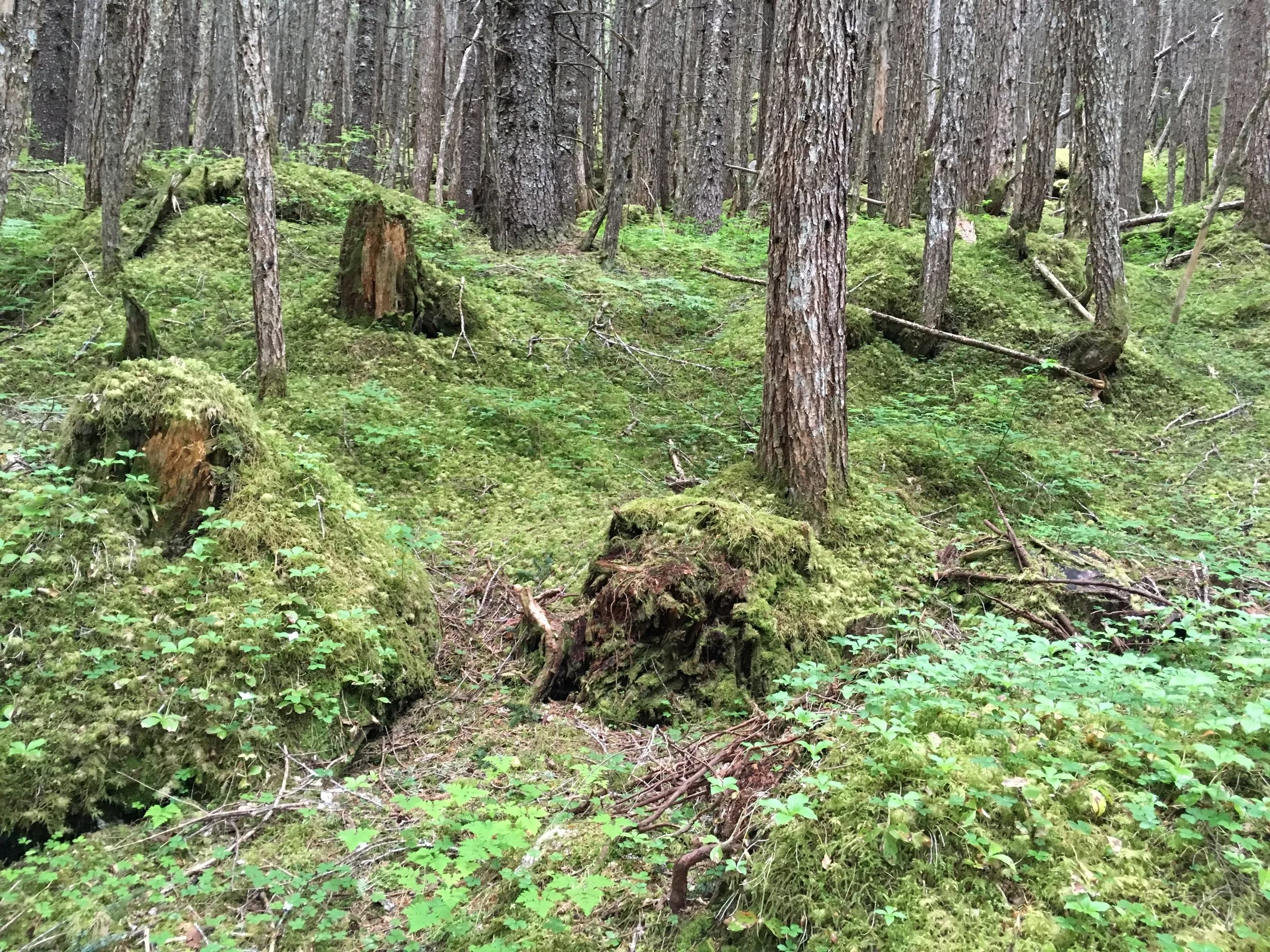
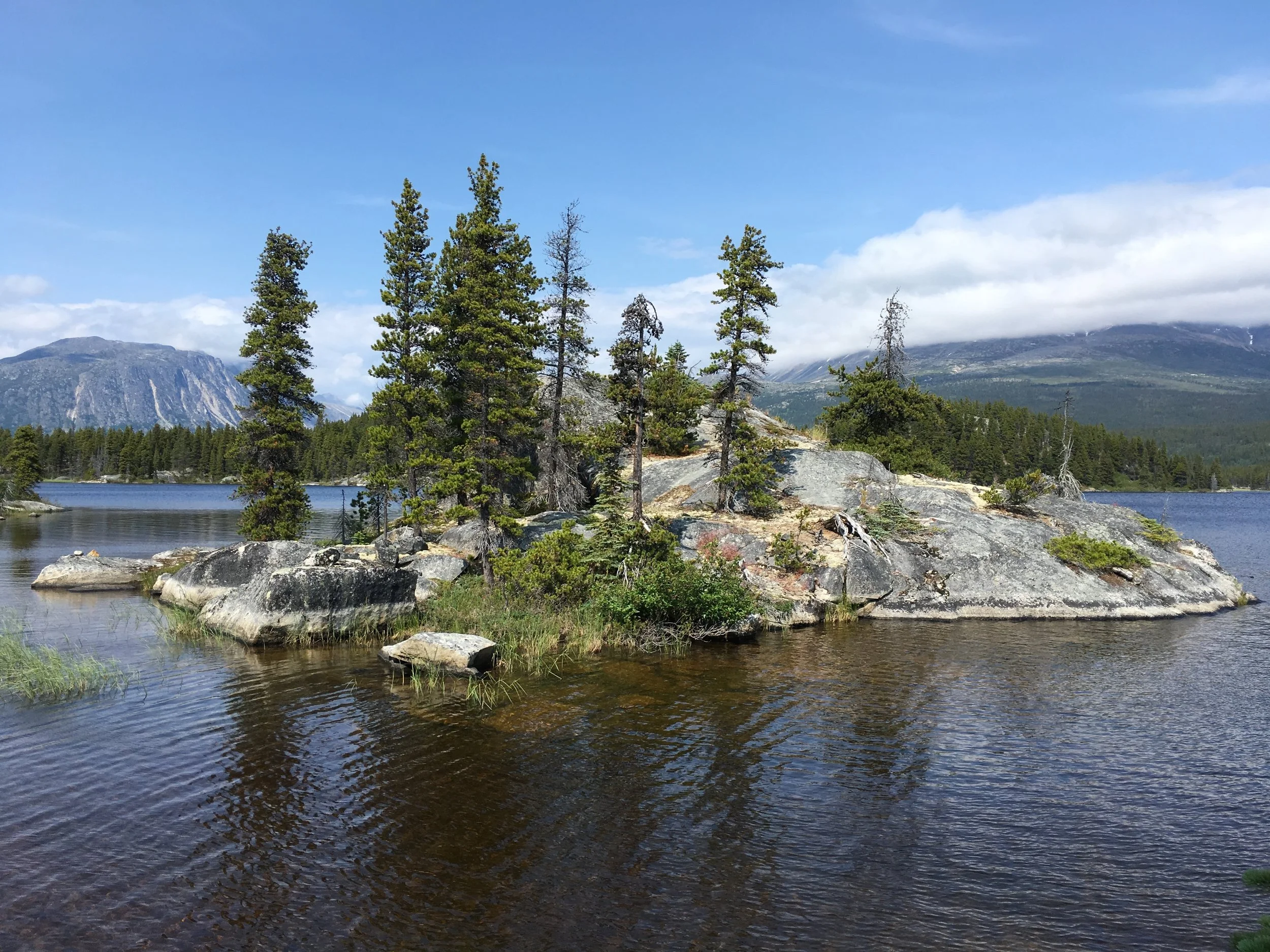
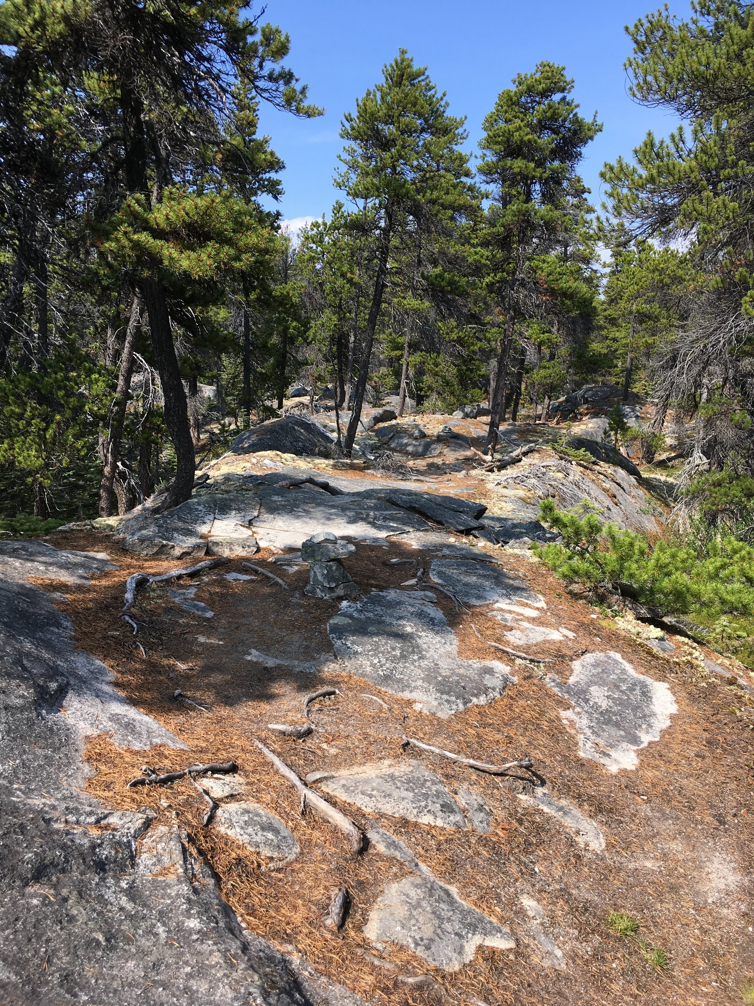
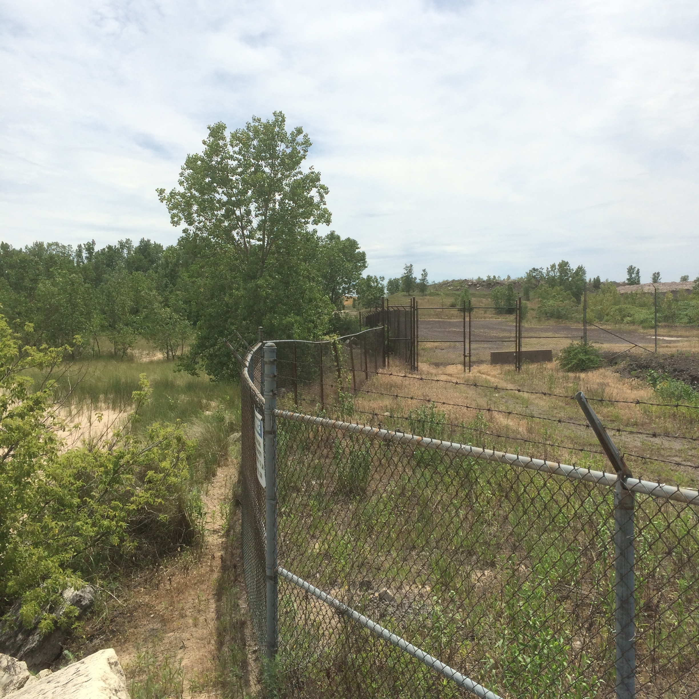
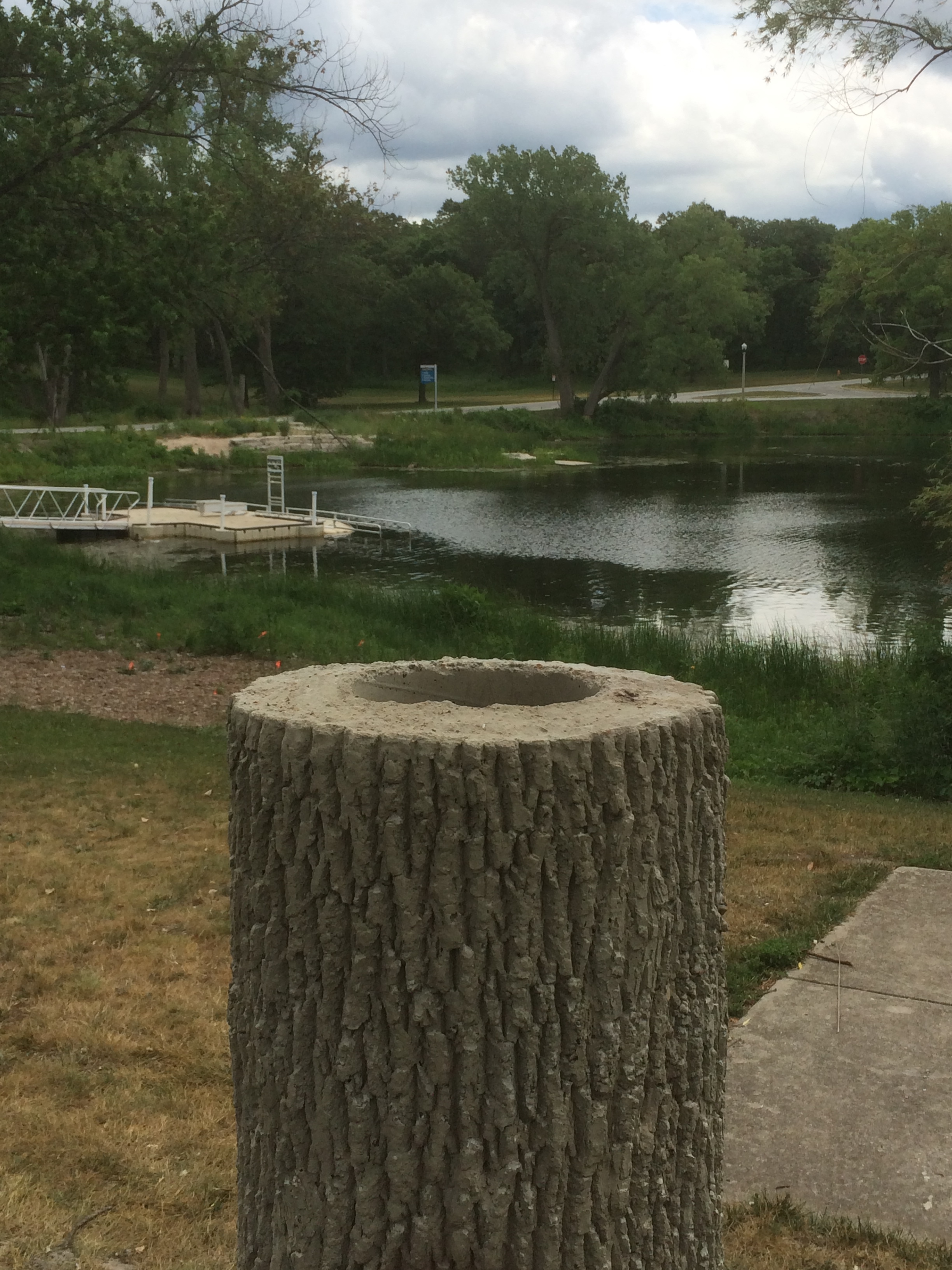
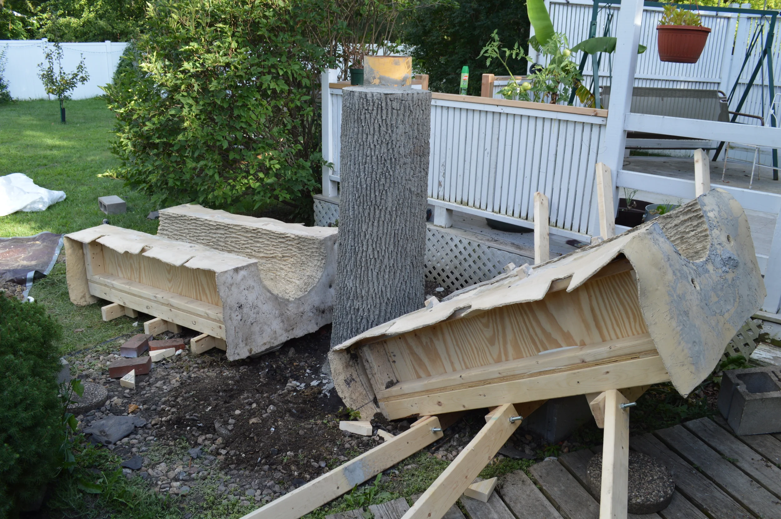
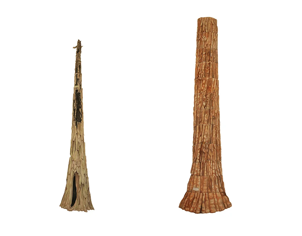
For the cache, I hollowed out a few sections of a basswood tree that recently fell behind my house. These husks blend into the landscape and house the prints from the elements. Two separate caches of prints are at the Seven Mile Creek County Park between Mankato and St Peter, MN and one will be installed on the Bell Museums grounds soon.

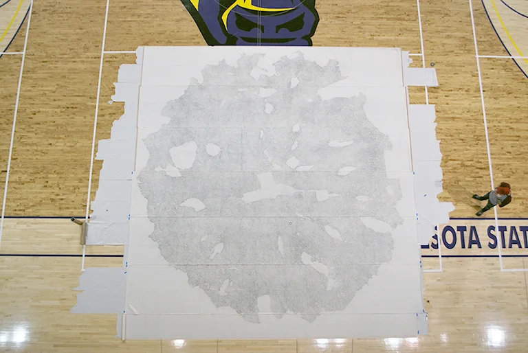
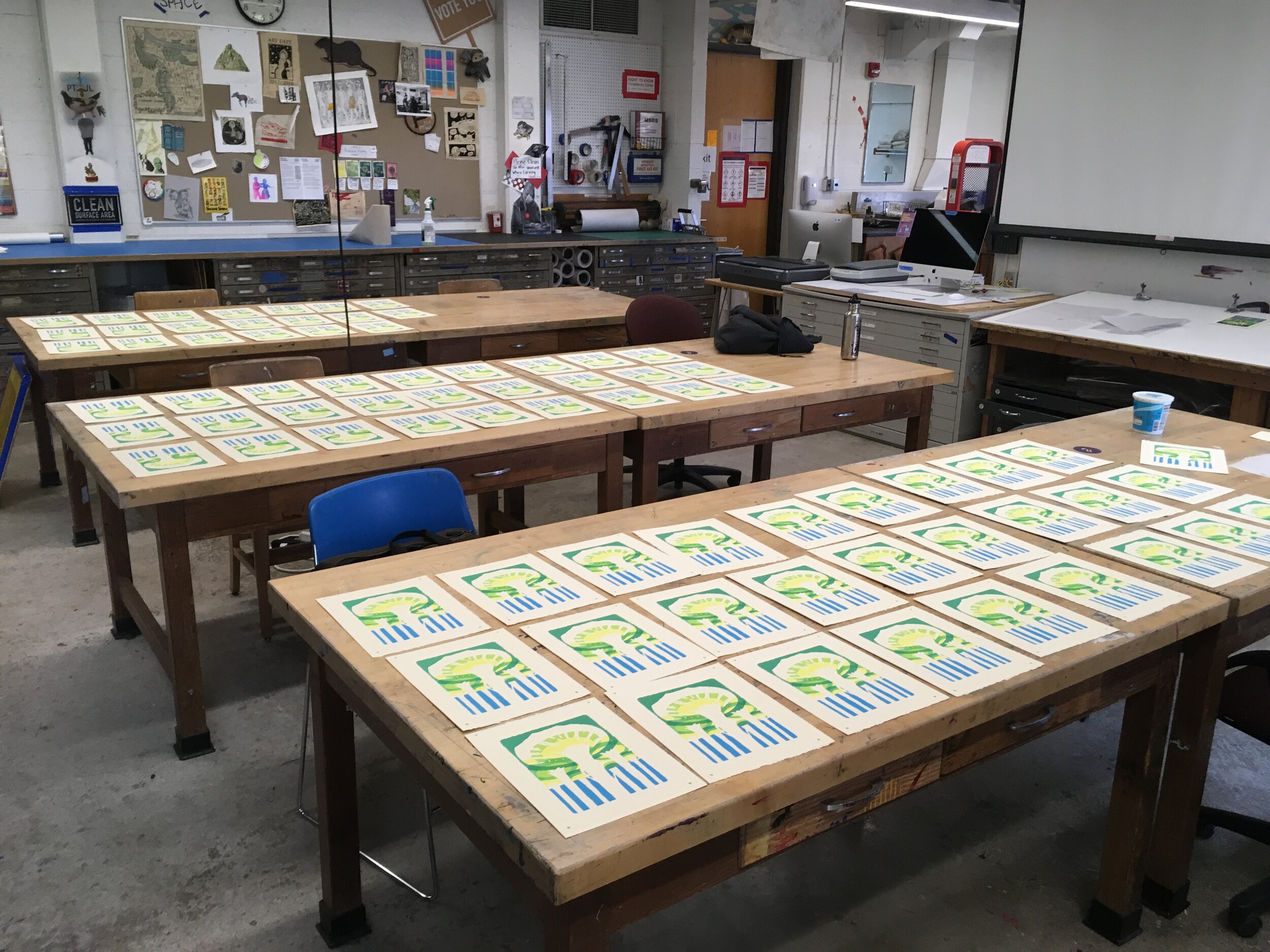
The print is called “Connection.” It consists of five layers of screenprinting with a key(black) relief printed layer. I printed an edition 60 prints to give away in 3 locations. This short video summarizes the hand-printing processes that went into the finished work.

Thanks:

  • THANK YOU to Cellar Press and Anne Makepeace at the Grand Center for Arts and Culture in New Ulm for access to their Vandercook press and their outstanding studio.

  • THANK YOU to the Bell Museum and the McKnight Foundation for making this work possible.


3. Connecting to Minnesota's Forests: Past, Present and Future

Resident Artist Research Project - Bell Museum

banner.jpg

3. Everything We Touch - Faux Stone Cairn Project

Everything we touch we turn to concrete. 

Cairns are constructed collectively, sometimes over vast periods of time.  One person lays a stone, eventually you have a pile. There is something sacred about this ritual that extends beyond our differences. Stone cairns have been used to mark funereal sites, monuments, and navigation routes. I first encountered them marking a trail above the treeline in Hew Hamshire’s white mountains in 2006.

Another surprise in the white mountains was a parking lot atop the highest peak. After hiking a few days towards the Mt. Washington summit I found carloads of people, bathrooms, concessions, and a post office. Following stone cairns to a summit parking lot at 7,000ft, the cairns felt less sacred, and more like concrete.

Glacial granite found stones (center), Concrete Stones (right/left)

Glacial granite found stones (center), Concrete Stones (right/left)

Everywhere we go, we bring concrete. We drive up to vistas with the best views, we dam rivers to feed desert croplands, we build pipelines through sacred rivers. We even bring concrete Into our domestic spaces to mimic nature. We enjoy faux stone pavers and woodgrain floor tile, we like the idea of nature when it makes us more comfortable. Nature as a surface.

Silicon molds and rock castings

Silicon molds and rock castings

For this project, I decided to use the cairn form to consider this transition from sacred to profane. I made molds of two granite stones found near home then cast 45 fake rocks in concrete. I cast one stone in iron, along with some other objects, at a casting workshop in Tucumcari, NM.

In 2018, I was carrying Robin Wall Kimmer’s book Braiding the Sweetgrass while hiking the Chilkoot trail in Eastern Alaska and Canada. I was surrounded by mosses, lichen and the rusting detritus of the Klondike Gold Rush while reading about the symbiotic relationships between algae and fungi, and the remarkable ability for lichen to break down granite and steel. After two weeks exploring this environment, I saw all the gold rush rust not as artifact, but as trash left in the woods. I came to the conclusion that the forest would not recover until it had fully swallowed the gold rush remains. Remarkably, lichen had colonized the old iron stoves, sawblades, and food tins, and mosses were swallowing the 120 year old tree stumps left in the wake of the miners.

The last element of the cairn project celebrates this slow and steady work of nature on the built environment. I collected specimens from my immediate surroundings. From my own yard to an abandoned Kentucky Fried Chicken parklot, I found lichen and mosses on tree branches, rocks, steel railings, asphalt shingles, aluminum gutters, and lots of concrete.

Rock along superior hiking trail, August 2019

Rock along superior hiking trail, August 2019

I blended specimens into slurries of yogurt and milk and then painted them onto the faux stones. After a few weeks of nurturing, there is new growth, possibly some bacteria as well as some lichen and or moss. The following images share some gathering sites and the application process.

With the generous help of the Bell’s Jennifer Stampe, I installed the sculpture on the Bell museum grounds on July 2nd 2020. This sculpture will be a component of the Bell’s “Learning Landscape”. The iron stone will rust and stain the concrete, and hopefully, the lichen and mosses will start their slow work on these fabricated surfaces.

Thanks:

  • THANK YOU to Daniel Stanton at the U of M’s College of Biological Sciences for his generous input on byrophytes and lichen.

  • THANK YOU to Yousif Dell Valle for all the casting help.

  • THANK YOU to Jennifer Stampe at the Bell for all her work on support for this project.

  • THANK YOU to the Bell Museum and the McKnight Foundation for making this work possible.

Reads:

2. Connecting to Minnesota's Forests: Past, Present and Future

Resident Artist Research Project - Bell Museum

banner2.jpg

2. Seven Mile Creek - A Deeper Look at the Land Near Home

Seven Mile Creek County Park is on ancestral lands of the Dakota between Mankato and Saint Peter in Nicollet County.  The heart of the park is a creek that collects the waters from a 23,000-acre watershed and sheds them into the Minnesota River.  The 6-mile long creek is, ironically, called 7-mile Creek as it was located seven miles from the courthouse in St. Peter.  I have unsuccessfully wandered old maps for a less arbitrary name for the creek, perhaps describing the character of the area, or what the local Dakota called the creek.

The park is essentially a series of forested ravine fingers draining the watershed from high-prairie farmland to seven-mile creek, an incised stream running west to east and emptying into the Minnesota River Basin which flows north to meet the Mississippi River at Bdote Minisota. The majority of the 630-acre expanse is along the namesake creek and its trickling tributaries, but there is also a section following the sandy banks and cottonwood floodspace along the Minnesota River.

Before colonization, the watershed surrounding the park was mostly prairie, wetland, and oak savanna with some lakes and sections of the late great big woods that once stretched across southern Minnesota. Today most of the wetland is drained, the big woods are gone, and 80% of the land is corn and soybeans. It’s the story of the Midwest, tillable land is tilled, lakes and wetlands are drained, the hardwood forests are left to the ravines and margins. Despite these facts, the story is changing, becoming more complex and hopeful. 

Some farmers are working with the 7-mile creek Watershed Partnership to improve water quality while keeping the soil in place and reducing erosion.  Some use cover crops and or have dialed-in drainage systems to manually control the water table below their crops. This allows them to limit water flow to the ravines during storm events. 

The relatively small watershed and park have actually been studied extensively.  I see students from Gustavus Aldophus College taking water samples or researchers from the University of Minnesota conducting surveys. I met a graduate student doing a poster presentation on the park some 450 miles away at Michigan Tech. I gather that the park is a sort of farmland/watershed case study in a system similar to many other places with similar problems.  


Beyond a spattering of glacial boulders, Jordan sandstone is the visible outcropping of rock in the park.  It ranges from tan to bright white.  It’s soft enough to carve with a stick in many places, and park goers cannot resist gouging their initials in the eroding rock.  The limestone local to this area, kasota stone, once blanketed the sandstone.  It likely washed away around 10,000 years ago when the glacial River Warren escaped the great glacial Lake Agassiz forming the Minnesota River Valley.

Jordan sandstone on south side of creek in June

Jordan sandstone on south side of creek in June

The forest is composed of mostly northern northern red oak, hackberry, maple, basswood, boxelder, elm, ash, hickory, cottonwood, some aspen, a few patches of birch, some bur oak, some Kentucky coffee tree, some black walnut, some sumac and willow on the fringes. The largest known cherry tree in Minnesota is in the park. 

Spring brings trout lilies, wild ginger, ramps, blood root, bell wort, ostrich ferns, jack-in-the-pulpit, trillium, dutchmen’s breeches, virginia waterleaf. And a little later columbine, maiden hair ferns, horsetail, honeysuckle, black rasberries, and unfortunately loads and loads of stinging nettle.  In the prairie patches, black eyed susan, coneflowers, fleabane, bee balm, golden rod, milkweed and much more.

Young lions mane mushroom, a delectable edible, starting on rotten log in early September

Young lions mane mushroom, a delectable edible, starting on rotten log in early September

Morels round the dead elms the 2nd week of May as pheasant backs protrude from elm carcasses and oysters cantilever off elms and other hardwoods. From late May into June-September, chicken of the woods grow from dead/dying red oaks/bur oaks. In late June early July, coral rise from rotting logs, and chanterelles begin to fruit around living red oaks. From late summer into the fall I find puffballs and hedgehogs. In the fall come bears head and lions mane. While other forests in the area have porcinis (king boletes), hen of the woods, and more significant patches of chanterelles, these species are limited in 7-Mile. 

Turkey eggs on forested ravine in late May

Turkey eggs on forested ravine in late May

Wildlife in the park ranges from birds to mammals to amphibians. I’ll list a few that I see regularly. There are gray and black eastern gray squirrels, red squirrels, chipmunks, raccoons, garter snakes, northern leopard frogs, toads, opossums, barred owls, several types of hawks including the northern harrier and red hawk, loads of pileated woodpeckers, loads of white-tailed deer, turkeys. A rare black bear was spotted in the area last fall, but I have not been lucky enough to see it or its scat. Most the beavers in the park have built lodges into the banks of the Minnesota River, but I have seen recent evidence of them heading up the creek.

Cottonwood beaver kibble on the western bank of the Minnesota River in early March

Cottonwood beaver kibble on the western bank of the Minnesota River in early March

While I have shared a number of facts about this land, the information above has mostly been filtered through my own naive experiences, and I had some help with flower ids from Rachel James.  For a deeper dive into the research from professionals follow the links below. 

Park Map / Brochure: https://www.co.nicollet.mn.us/DocumentCenter/View/4670/Seven-Mile-Creek-Brochure

Bird Checklist from park: https://www.co.nicollet.mn.us/DocumentCenter/View/4669/Seven-Mile-Creek-Bird-Checklist

Seven mile creek watershed partnership: https://www.7-milecreek.org/

Interactive Park Map: https://mrbdc.mnsu.edu/sites/mrbdc.mnsu.edu/files/public/major/midminn/subshed/sevenmi/vtour/parkmap.html#

Another interactive tour of the park and watershed: https://mrbdc.mnsu.edu/sites/mrbdc.mnsu.edu/files/public/major/midminn/subshed/sevenmi/vtour/smvt_2.html

Actively incising river evolution... in central Minnesota by Karen Gran, University of Minnesota Duluth: https://serc.carleton.edu/vignettes/collection/25560.html

 An interactive site about water monitoring throughout the creek: https://www.carleton.edu/departments/geol/Links/AlumContributions/Antinoro_03/SMCwebsite/index.htm

Plants and Flowers: https://www.minnesotawildflowers.info/

Link to some of the glacial history in the area, the great glacial Lake Agassiz, and the glacial River Warren that formed the MN river valley: https://mrbdc.mnsu.edu/minnesota-river-valley-formatioa

1. Connecting to Minnesota's Forests: Past, Present, Future

Resident Artist Research Project - Bell Museum

IMG_4564.jpg

1. The pandemic

I have been working on a few projects for a while now, but officially my Resident Artist Research Project at the Bell Museum, kicked off at the start of June. The residency will carry from June through July, and then pick up again for the month of September in preparation for an exhibition and workshop at the Bell. I’ll be creating some short videos to share online, and adding blogs posts about specif projects right here. Thank you to the Bell Museum for this opportunity!

Starting a residency during a pandemic is of course unexpected and not ideal. That said, the work I’m creating focuses on being outside, and having moments of personal connection. I believe that the more we foster tangible relationships with the natural world, the healthier the planet. Everyone needs safe and comfortable access to the landscape from children to political and spiritual leaders. From my vantage point in southern Minnesota, the pandemic has brought a lot more people outside.

What access points are near you? Where can you go without a car or public transit? Can you bring your kids outside as you homeschool? Is easy access to greenspace a basic need? These questions are important to ask, especially as we struggle to mitigate the causes of our warming climate, especially during a pandemic, especially as we face the inequity clogging every facet of life. It’s difficult not to have an abundance of cynicism right now. Even the "outdoors,” like much of our society is not always a welcoming a place for everyone. I have to hope that together we are approaching something new, some new meaningful restructuring of our values, and I hope that greater access and appreciation of the land are part of meaningful change.

I am lucky to live adjacent to a county park in Southern, MN between Mankato and Saint Peter.  I spend a lot of time hiking the ravines, deer trails, and common paths maintained by the park.  Before the pandemic, in preparation for this residency, I spent a few weeks in northern Minnesota. And while I am making work about the forests up there, my local county park has become a focal point for the daytoday of this Bell residency. 

This park has been processed and manipulated, is surrounded by a watershed of eroding farmland, and certainly does not have the grandeur of the northwoods, but it's exactly the type of place that should be celebrated and expanded. Of the many things we are processing during this intense moment, I hope we are learning to better appreciate the outdoors spaces close to home.

Before covid, I mostly had the park to myself.  Today, the trails are packed, joggers, anglers, walkers, pot smokers, dog walkers...people of all ages.  You can really see the impact on the park.  Deer trails are becoming worn footpaths, the main paths are getting wider, they are bringing in more toilets, starting to spray the stinging nettles, adding more parking.  All this action, all these people, together, we are increasing erosion and hampering the undergrowth. And even though this new presence dulls my immediate experience, I’m glad we are all here. 

The more people that love these places, as much as the monumental vistas of the north shore, the richer our daytoday lives.  We have to meet our landscape spaces where they are at.  The more people outside, the more likely we'll create new parks, the more likely our leaders will make responsible environmental policy decisions.  As much as I love being alone in this park, I hope once the pandemic subsides, these people keep coming back.

Side stream at 7 Mile Creek County Park - June 2020

Side stream at 7 Mile Creek County Park - June 2020

Lost

The Late Great White Pine, and the Superior National Forest

The Late Great Pine Forests & Death by a Billion Cuts, two layer woodcut print with waxed paper, 40”x120”

Visiting a small patch of remaining old-growth, it’s easy to imagine how the vast white pine ecosystems of Minnesota once rivaled the complex drama of any old-growth forest. They were an infinite resource. They were a cultural resource. As these great forests brought wealth to settler communities at the turn of the century, Indigenous peoples watched the great rivers carry their homeland to the sawmill in less than 15 years.

The Late Great White Pine Forest. Color woodcut, 40”x120”

The first significant saw mill was in Stillwater, and one of the biggest log jams in the history of the country happened here as all that white pine lumber floated down the St. Croix River to the mill. Jams were broken up by hand and with dynamite.

Death by a Billion Cuts. Woodcut, 40”x120”

Like much of the north-eastern United States, the upper Midwest, and southern Canada, Northern Minnesota once had an enormous acreage of dominate pine forest. These massive trees, many over 400 years old, grew tall and straight, and were strong and light weight. They were the perfect lumber for any number of construction projects from timber framing to ship masts. More than 100 years before logging began in Minnesota, The Eastern White Pine even played a role in the American Revolution.

As the royal navy of Great Britain had exhausted European forests for ship building, they discovered the straightness, and flexibility of the white pine as a superior mast wood. The Crown coveted the white pine forests so much that they wanted all the best specimens for themselves. The King of England issued a charter near the turn of the 17th century stating that white pines with a diameter of 24in or larger were the property of the crown, and would be shipped to England to supply the navy. King George even sent his men to walk the forests marking the mast-trees with three hatchet strokes commonly called the “King’s Broad Arrow.”

Unsurprisingly, the settlers continued cutting and selling the lumber, infuriating the Crown, and in part, contributing to the American Revolution. Some of the first American flags, revolutionary war flags, even celebrated the white pine in their iconography.

After the coastal east was combed, loggers continued west to places like Michgan, Wisconsin, and ultimately Minnesota. Hiking the 300-mile Superior Hiking Trail, canoeing the boundary waters, traveling through the large forest ecosystems of northern Minnesota - all this land held the westernmost reaches of the eastern white pine. And while there are a handful of old growth survivors along the way, these white pine forests have been largely replaced with faster growing/short lived species like birch, aspen, cottonwood.

Old-growth Pockets in Northern Minnesota

White pine portraits. Woodcut prints.

The Superior National Forest grove near Two Harbors - White Pine Trail

This short, 1000 feet, loop has an interpretive trail through old-growth with nine stops. It’s about a half hour inland from Two Harbors.

https://www.fs.usda.gov/recarea/superior/recreation/recarea/?recid=77755&actid=50

https://www.fs.usda.gov/Internet/FSE_DOCUMENTS/stelprdb5194351.pdf

The Arrowhead Trail & the Gunflint Trail

There is a nice grove straddling the arrowhead trail on your way to McFarland Lake or the terminus of the Superior Hiking trail. These trees are said to be quite old, 185 years, but their growth has been stunted due to an abundance of bedrock. The spot is worth checking out if you are in the Grand Marais area. The white pines tower over the rest of the forest. You can also find a nice patch driving along the Gunflint Trail.

The Lost 40

This 40 acre plot in north Central Minnesota was never logged. Due to a survey error, the land was thought to be a lake, and was passed over. There are old-growth red and white pine. It’s amazing to see the thriving ecosystem and think about the long-evolved relationship between the under-story and canopy. A trail leads through the forest and one of the largest red-pines in the state is along the way.

The Superior Hiking Trail

Through-hiking the 300 miles Superior Hiking Trail from Duluth to Canada promotes an intimate engagement with the forests of the past and present. There are patches of old white pine scattered throughout. In most cases, the survivors are growing in extreme locations (the steep edge of a ravine for example) where logging would have been too difficult. There is also quite a bit of red pine, but much of this seems to be planted for later harvests. The southern stretches of the trail are mixed conifer and hardwood forests, while the northeastern most sections carry through the only boreal forest ecosystem in the lower 48.

These forests were clear-cut steadily from the late 1800s to the 1930s. New tree populations took hold, deer (who like to eat young pines) populations grew, invasives like blister rust moved in, natural fires diminished, and now the tree that once dominated struggles to reach maturity. We now have completely different ecosystems with more erosion, quickly shifting forests, different flora and fauna, and not much in the way of long-lived trees that can establish a canopy system and a stable environment.

There is a lot of planting going on, especially in parks and national forest land. Plots of forests are mechanically cleared as natural fires would have cleared them in the past. Seedlings are planted and fenced off to protect them from deer.

Some Reccomended Reads:

American Canopy: Trees, Forests, and the Making of a Nation - Eric Rutkow

North Country: The Making of Minnesota - Mary Lethert Wingerd

The Hidden Life of Trees - Peter Wohlleben

The Overstory: A Novel - Richard Powers

Calumet Artist Residency

Black Oak Savanna, Indiana Dunes National Lakeshore

Black Oak Savanna, Indiana Dunes National Lakeshore

In June of 2017, I enjoyed 2 weeks as the Artist in Residence at the Calumet Artist Residency in Gary, IN. I have been to Gary a number of times over the years, but I have not previously had the time and space to develop a concrete connection to this unique and dramatically varied environment of the dunes.

During the visit, I toured the downtown of Gary and had the chance to go in some historic architectural spaces.  The WPA funded, Gary Post Office (1936), is open to the elements. Ostrich ferns oscillate on the floor in patches where the sun cuts through the open roof.  There are plans to stabilize and re-purpose the City Methodist Church (1925), one of the first million dollar churches in the country, into a ruins garden open to the public. The boarded up windows of Union Station (1910) have been replaced with murals, and community members are creating a public garden around the structure. 

These sites are heart-wrenching and unmistakably beautiful in their states of decay, but there is also an immense weight attached to them that I'm guessing the people of Gary have to carry around with them everyday.  While it's uplifting to see the community gathering around and bringing positive energy to this story, as an artist, this complex social history is not my story to tell.   Instead, I decided to use my short residency time to connect to the natural history of this area – the plants and animals, the humidity, the wind, the water and the clouds.

The residency is in the Miller area of east Gary next to the national park.  And while Miller is inseparable from the downtown story, for me, the narrative here is more about a natural ecosystem fighting and shining between a lakeside powerplant and the largest steel mill in North America. 

The line - Google screen shot

The line - Google screen shot

US Steel is the founder, and arguably the destroyer, of Gary as well as the NIMBY neighbor of the national park.  People have worked to protect this area.  From historic organizations and individuals like "Save the Dunes," who fought for the establishment of the national lakeshore in 1966 to contemporary artist/activists like the Calumet Residency founders Corey Hagelberg (http://www.coreyhagelberg.com/) and Kate Land (calumetresidency.com).

The residency house sits at the top of one of the tallest forested dunes in the area.  A short walk down and across Lake Street will take you into the national park. 

Dunesteps to the residency house

Dunesteps to the residency house

National Park Trail

National Park Trail

In the park, sandy paths break off in multiple directions into the oak savanna.  These trails go up, down, and between the dunes and lagoons.  Furrowed black oak trunks protrude from the ferns, flowers, and grasses that cover the under story. 

Lagoon in the park

Lagoon in the park

The trail transitions toward the beach into a more raw and windswept dunescape.  The oaks become gnarled and dwarfed, marram grasses begin to take root, even prickly pear cactus line the winding trail. 

Even with the nearby public beach and adjacent residential areas, these inter-dunal valleys create surprisingly private spaces to relax and reflect.

Crossing the last sandy dunes leads to the beach.  You can follow the edge of the national park west to the imposing barrier of US Steel or you can head east to public beaches and the historic Marquette Park. 

The east barrier of US Steel - adjacent to the national park

The east barrier of US Steel - adjacent to the national park

 Another highlight of this residency was a public sculpture I created for Maquette Park.  A slide show of images and project information can be found below.  I am also working on a woodcut that I will add to this site when finished.  Thanks for taking a look. 

In Memoriam

The emerald ash borer has hugely impacted the ash population of northwest Indiana including the Miller neighborhood of Gary.   This sculpture serves as a memory to the lost ash trees but also to promote awareness about other native and invasive species of plants and pests in this area.  The sculpture will be a feature of a new native-plant educational garden in the park.  Doubling as a planter, the concrete sculpture will sprout native species from the trunk of the memorialized ash tree.  With this sculpture, there is an element of rebirth or growth from decay, that reflects the optimism of the natural world and the people of Gary.

Follow these links to more information about this project and or the EAB in your area:

http://www.joshkwinkler.com/eab

http://www.in.gov/dnr/entomolo/5349.htm

http://www.emeraldashborer.info/

Pinus longaeva

This post is broken into 3 parts: 1st a short overview of the species (The Ancient Bristlecone Pine), 2nd the Prometheus story and the Wheeler Peek Bristlecones (The Great Basin National Park and my quest for the Prometheus Stump),  and 3rd the Inyo National Forest groves in eastern California (The White Mountain Groves). 

All photographs were taken in the summer of 2015.  A reading list is at the bottom of the post.

1. The Ancient Bristlecone Pine

Time shapes form, adversity builds character

Group of ancient bristlecones near the Prometheus stump on Wheeler Peak

Group of ancient bristlecones near the Prometheus stump on Wheeler Peak

Pinus longaeva, the Great Basin Bristlecone, exists in Utah, Nevada, and California.  The trees grow in large clusters in poor soil where there is sparse undergrowth and little competition.  This lack of density / ground-cover provides minimal fuel for forest fires contributing to tree longevity. The Great Basin Bristlecone can live for more than 5,000 years.  This absurd lifespan is a direct result of the adverse conditions in which the oldest trees exist.  The drier, the colder, the windier the climate the slower the trees grow.  The slower the growth, the denser the wood.  This extreme density allows these dwarf pines to stand up to the elements without toppling over. 

From a distance. Grove of ancient bristlecones on California's White Mountains Methuselah Trail

From a distance. Grove of ancient bristlecones on California's White Mountains Methuselah Trail

In all trees, the nutrients and moisture that provides life to their foliage is carried from the earth to the branches through the inner bark, the cambium layer, and the new growth sapwood of the outer rings - all of which is just below the outer bark.  It is not uncommon for the oldest bristlecones to live on for hundreds of years with only a single strip of bark.  A 5,000 year old tree, while producing viable cones and only a few sprigs of green growth, may be 90% or more dead wood standing. 

Life-blood-bark-strips on an ancient bristlecone.  4000+ yr old tree in California's White Mountains Methuselah Grove. 

Life-blood-bark-strips on an ancient bristlecone.  4000+ yr old tree in California's White Mountains Methuselah Grove. 

Bristlecones grow somewhere between 10 and fifty feet tall.  Trees with a nearby water source and more nutrient rich soil will grow quickly and die young.  This quick growth generates soft heartwood susceptible to rot, insects, and wind.  Conversely, the 4000+ year old trees, may only reach 15 feet tall and a few feet across. The Patriarch Tree, the largest living bristlecone, is a young 1500 years old, while the Methuselah (somewhere around 5000yrs) is a small fraction of the Patriarch in mass. 

Patriarch Tree, 1500yrs, Patriarch Grove - The remote White Mountains of the Inyo National Forest.

Patriarch Tree, 1500yrs, Patriarch Grove - The remote White Mountains of the Inyo National Forest.

Both researchers and the National Park Service have done a great job hiding the identity of the oldest trees.  I have found 3 historic photographs of the Methuselah(currently considered the oldest), but I myself did not find it while walking the Methuselah trail.  And, In truth it is better this way.  While exploring some of the old mines and younger bristlecones in the White Mountains, I found some of the trees had been carved up with knife. 

Tree vandals in the 21st century, a heart symbol knifed into the bark of a bristlecone in California's White Mountains.

Tree vandals in the 21st century, a heart symbol knifed into the bark of a bristlecone in California's White Mountains.

The Great Basin National Park and my quest for the Prometheus Stump

Wheeler Peak

Wheeler Peak

My quest to Great Basin National Park was a general effort to see the ancient bristlecones, but it was also an effort to find the stump of the Prometheus tree.  This ancient tree of Wheeler Peak was potentially the oldest of all trees before it was cut down in 1964 by North Carolina graduate student, Donald Currey.

The circumstances around this event vary from person to person, from publication to publication.  There are stories of his Swedish increment borer breaking off in the trunk warranting the felling of the tree.  There are stories that Currey was vainly seeking the oldest tree for acknowledgement.  Either way, Currey likely cut down the tree to accurately date it.  To date these trees you need to a consistent core from the outer bark to the inner heartwood.  Their gnarly growth patterns, and their eroded deadwood, in many cases, make this nearly impossible. 

Currey consulted with The Forest Service and they agreed to cut down the tree for his research.  At the time, It was believed that the only 4000+ yr old trees were in the White Mountains of California.  Currey wanted to prove that there were 4000+ yr old bristlecones on Wheeler Peak in Nevada.  He knew Prometheus was one of the oldest, and he assumed there were others in nearby groves that would be studied after the news of his 5,000 yr old find was published.  Unfortunately for Currey, the Prometheus tree WAS one of a kind.  Not a single bristlecone comparable to Prometheus has been found in the area.

The main flaw with Currey and his killing of the oldest tree is that he did not first consult the scientists who had already surveyed the trees.  That he likely knew he had something special in Prometheus and decided to cut it down anyway. That he was a geology graduate student, and he did not consult with his superiors or with scientists devoted specifically to studying the bristlecones.  Edmund Shulman, a dendrochronologist and bristlecone pioneer at the Laboratory of Tree Ring Research had published an article in National Geographic about the ancient bristlecones in 1958 (6 years before the felling of Prometheus).  Currey sites the Shulman article himself in his 1965 Ecology publication about the Prometheus tree. 

To be fair, other researchers, including Shulman, have cut down ancient bristlecones for specific chronology purposes.  They undoubtedly had a better understanding of what they were doing, and selected their trees carefully.  But in the end, what is the difference between cutting a 4000yr old and a 5000yr old? 

First view of groves from Mather's Overlook

First view of groves from Mather's Overlook

In Great Basin National Park, from Mather's Overlook, you can get a good glimpse of Wheeler summit, the edge of the treeline, and begin to visualize the off-trail hike to Prometheus. 

The edge of the forest.  Glacial Moraine at tree line on northeast face of Wheeler Peak, (Near Prometheus Stump)

The edge of the forest.  Glacial Moraine at tree line on northeast face of Wheeler Peak, (Near Prometheus Stump)

I parked the auto at the Wheeler peak campground.  After a few hours of increasing elevation and bouldering off-trail through massive fields of jagged quartzite, I made it to the edge of the forest. 

Glacial Moraine at tree line on northeast face of Wheeler Peak, (Near Prometheus Stump)

Glacial Moraine at tree line on northeast face of Wheeler Peak, (Near Prometheus Stump)

Edges can carry emotional, visual, spiritual weight.  But beyond natural water bodies and the human built environment, it's rare to find an edge so clearly defined, so significant.  It could not be a more dramatic spot for the oldest living tree.  I sat down my day pack, and instantly, I saw a downed tree about 30 yards off with a wedged section clearly cut from it trunk.   

The Prometheus Tree

The Prometheus Tree

I have only been able to find a few photos of the living Prometheus in print.  Seeing images of the tree alive, after visiting the remains, its difficult not to be upset about its demise.  In one of the documentary photographs by Great Basin Naturalist, Keith Trexler, Currey has climbed the tree for the camera, maybe as a scale reference, but out of context, its difficult not to see a tragic expression of ownership on his smiling face. 

The Prometheus Tree

The Prometheus Tree

The Prometheus Stump

The Prometheus Stump

The Prometheus Tree, according to Currey's Ecology Article, grew at an altitude of 10,750ft.  It had "a dead crown 17ft high, a living shoot 11ft high, and a 252-inch circumference 18 inches above the ground...Bark was present along a single 19-inch wide north-facing strip."  Currey dated the tree around 4900 years.   

The Prometheus Stump

The Prometheus Stump

The Prometheus Stump (Foreground), Wheeler Peak (Background). 

The Prometheus Stump (Foreground), Wheeler Peak (Background). 

Not unlike the Discovery Tree of the sierras, the felling of Prometheus, brought awareness and increased conservation to these ancient trees.  Even though Wheeler Peak was not officially declared a national park until 1986, the attention and outrage brought by Prometheus, played a pivotal role in the transition of this area of the Snake Range into Great Basin National Park.

The White Mountain Groves

DSC_0557.JPG

The majority of bristlecone data, and the majority of the oldest trees are concentrated in the White Mountains of the Inyo National Forest in Eastern California (about six hours driving from Wheeler).  The White Mountains are named for the white dolomite limestone that generate a highly alkaline soil.  The bristlecones are able to thrive in this basic dry soil with little competition from other species.

Methuselah Trail

Methuselah Trail

Shulman first walked the Methuselah trail in 1957.  He thought conditions were great for old growth dwarf trees.  Shulman describes this area as "the farthest limit of the dry forest edge, outcroppings of calcareous rock, and little rainfall--probably no more than 10 inches a year." 

Shulman's intuition was correct.  The Methuselah Trail is home to many 4000+ yr old Trees, most famously of course, the Methuselah, a "pickaback" type that Shulman dated in 1957 at around 4,600 years. Shulman refers to this tree as the Great-Granddad in his 1958 Nat. Geo. article.  He also talks about cutting down another "pickaback" variety: "to determine the life history of this strange pickaback form of tree, we hardened our hearts and, at the very end of the field season, cut down a similar but somewhat younger specimen for detailed study."  This felled tree turned out to be right around 4000 yrs old. 

Core samples being prepared in lab at LTRR (not necessarily bristlecone)

Core samples being prepared in lab at LTRR (not necessarily bristlecone)

There is a remote research station high in the White Mountains between the Methuselah walk and Patriarch Grove.  This site, ran by the University of California, is where Edmund Schulman sorted through core samples from the Methuselah.  It was here that he had his eureka moment and determined it's age. 

Methuselah Trail

Methuselah Trail

Today, the Methuselah trail is a 4.5 mile loop that meanders through a grove of young and old bristlecone pines.  At the start of the walk, near the visitor's center, there is a creek bed that provides moisture to an abundance of young bristlecones.  This moisture allows the trees to grow tall quickly, but their lives are short lived.  They look like an entirely different species compared to the dwarfed ancients further down the trail.

Methuselah Trail

Methuselah Trail

Methuselah Trail

Methuselah Trail

Methuselah Trail

Methuselah Trail

The bristlecones of the White Mountains have provided an abundance of data since the 50s, and there is still an abundance of research that has not yet been accomplished.  By taking core samples from both living and dead trees, scientists are able to study tree ring growth patterns to build a climatic chronology for the past 11,500 years.  This science is so accurate, in fact, that the tree ring data is used for calibration in radio carbon dating.  

Methuselah Trail

Methuselah Trail

Methuselah Trail

Methuselah Trail

Methuselah Trail

Methuselah Trail

Dead snag on the Methuselah Trail

Dead snag on the Methuselah Trail

Tree labels on the Methuselah Trail

Tree labels on the Methuselah Trail

Bristlecone groves on the Methuselah Trail

Bristlecone groves on the Methuselah Trail

Methuselah Trail

Methuselah Trail

A gathering of rolling cones on the Methuselah Trail

A gathering of rolling cones on the Methuselah Trail

Methuselah Trail

Methuselah Trail

The Patriarch Grove...

Patriarch Grove is a 12-mile northward drive from the Shulman Grove along White Mountain Road.  A short detour along the way will take you to The White Mountain Research Station - Crooked Creek (the site where Shulman dated the Methuselah tree back in 1957).  This off-the-grid station sits at 10,150 feet, and hosts a number of researchers, retreats, and field classes annually.

The unpaved route to Patriarch Grove

The unpaved route to Patriarch Grove

White Mountain Road is a rocky winding path best taken with a 4-wheel drive vehicle.  Unknowingly, I had rented a little Nissan Versa, which made the going extremely slow.  In the end, I pulled over and walked the last few miles on foot (partly because I was enjoying the sparse high desert scenery, and partly to avoid a flat tire).  

New bristlecone growth in Patriarch Grove.

New bristlecone growth in Patriarch Grove.

The density of trees in Shulman Grove (Elevation 10,100ft) is abundant compared to the sparseness of Patriarch Grove (Elevation 11,300ft).   That said, the rapidly warming climate of the past 50 years has produced a wealth of new growth bristlecones in the grove.

Once arriving at the Patriarch Grove park lot, there is a short 1/4 mile trail through some gnarled cliff grabbing bristlecones.  You can also get a nice glimpse of White Mountain Peak, the 3rd tallest mountain in the lower-48 @ 14,252ft. 

The whiteness of rocks, sparseness of vegetation, and drama of the grappling bristlecones make this grove particularly striking and otherworldly. 

Remnants of a dead forest.  Patriarch Grove. 

Remnants of a dead forest.  Patriarch Grove. 

Clinging to the mountain.  Ancient Bristlecone at Patriarch Grove

Clinging to the mountain.  Ancient Bristlecone at Patriarch Grove

A dead standing Bristlecone at Patriarch Grove

A dead standing Bristlecone at Patriarch Grove

The famed Patriarch tree.  At only 1500yrs, it has the largest mass of all living bristlecones.

The famed Patriarch tree.  At only 1500yrs, it has the largest mass of all living bristlecones.


Reference Reading:

  • Shulman, Edmund.  Bristlecone Pine, Oldest Known Living Thing.  National Geographic.  March 1958. 
  • Currey, Donald.  An Ancient Bristlecone Pine Stand in Eastern Nevada.  Ecology, Vol. 46, No. 4 (Jul., 1965), pp. 564-566
  • Lambert, Darwin.  Great Basin Drama, The Story of a National Park.  Roberts Rhinehart.  1991. 
  • Coen, Michael.  A Garden of Bristlecones, Tales of Change in the Great Basin. University od Nevada Press.  1998.